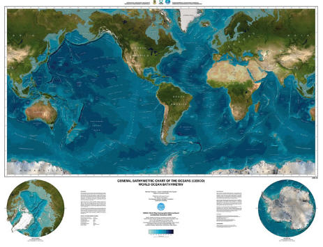
Sea-Floor Sunday #26: Global bathymetry map
There are several world maps that show bathymetry out on the internets available for download. Last week I came across one I had not seen yet.
GEBCO (General Bathymetric Chart of the Oceans) is an initiative joining the Intergovernmental Oceanographic Commission and International Hydrographic Organization.
The image below is a low-resolution snapshot of the global map they created.
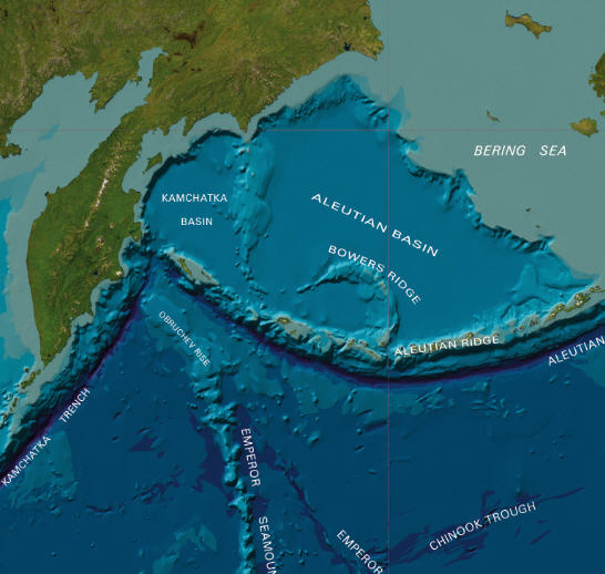
Here are a few close-ups showing some of the detail in this map.
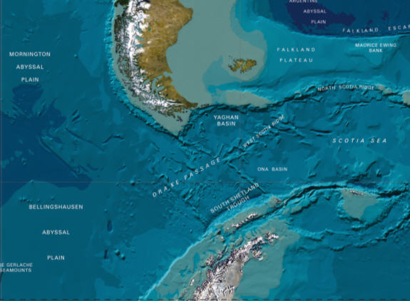
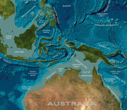
What I like about this map is that the land parts of the map are from satellite imagery … makes a nice combination with the blue-themed bathymetry.
There’s low-resolution (3.6 MB) version and a beautiful high-resolution (32.5 MB) version … if you have access to a plotter, sneak it into the queue and put it on your wall.
You can find the images here.
~~~~~~~~~~~~~~~~~~~~~~~~~~~~~~~~~~~~~~~~~~~~~~~~~~~~~~~~~~~~~~~~~~

Trackbacks