Where on (Google)Earth? #98 (and some updated stats)
BGC found my Wo(G)E birthday location near Reyes, Bolivia. The very first Where on (Google)Earth was Point Reyes just north of San Francisco.
BGC does not have a blog so he asked me to post his location for him.
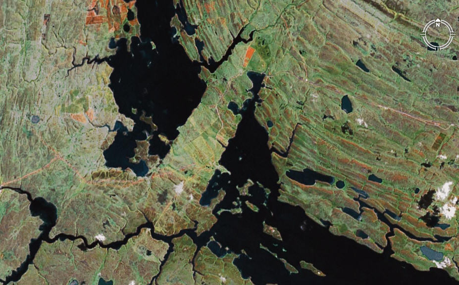
To make this a little more challenging, I trimmed the scale and image attribution information off the bottom of the image. The winner of this must include some geologic information … whatever is going on here, it is pretty cool.
The Schott Rule is in effect: you must wait one hour for every previous Wo(G)E that you have won.
Post Time: January 19th, 2008, 6:30 PM Pacific Standard Time (convert to your time zone here)
~
I updated some stats earlier today. These are wins by player through Wo(G)E #97:
Ron Schott – 28
Kent (magma?) – 7
sagan – 7
Lab Lemming – 6
BrianR – 5
Kim – 5
Zoltán – 5
Thermochronic – 4
Yami – 4
JMA – 4
Geology Joe – 3
Jim Repka – 3
John Van Hosen – 2
BGC – 2
…and then there are an additional 12 players with only one win. You’ll have to start winning some to see your name :)
Check out some interesting spatial stats regarding one year’s worth of Wo(G)E locations Lab Lemming put together here.
~~~~~~~~~~~~~~~~~~~~~~~~~~~~~~~~~~~~~~~~~~~~~~~~~~~~~~~~~~~~~~~~

are people looking for this one? … it’s getting close to Schott time … better hurry
I am…but…I think I am in the wrong place.
It looks like a flooded lake on a glaciated craton- and the top and botton seem to be different drainages. I had a look in the Quebec hydroelectric scheme lakes, but nothing caught my eye there…
Found it!
51°49’41.21″S
58°53’24.86″W
That’s the Goose Green area in the central part of the Western Falkland island. Google claims it was the site of a Battle of the Falkland War between Argentinia and the UK.
Geology is hard to find for me. But here it goes. Used to be part of Gondwana right night to what is now South Africa. That’s why ppl suspect to find gold and diamonds here. Also there is some oil potential. East and West (not on image) island are seperated by the Falkland Sound Fault. The islands have ben rotated around 180° after seperation from Gondwana with the East a bit less deformed. The southern part on the foto is part of a permian basin, the north other paleozoic rocks. That’s all I found…GE looks like there is some mountain building NE of the “bridge” thing with something that reminds of me of valley and ridge province in the US for example. Is that area some sort of failed rift? backarc? Forearc? I hope this is sufficient.
The area was certainly glaciated. I forgot to mention. That’s why we had the confusion with canadian cratons i think. Looks pretty similiar. It all seems pretty smooth.
Nice work Mathias … and thanks for the geo info, yes that is definitely sufficient … I look forward to #99. When you get #99 up put a link in this comment thread; the other day when I was putting together the stats, it is really neat to just be able to follow the entire history of Wo(G)E with one click per installment.
Sure will. This was quite a tough one.
WOGE 99 is up!
Here is a direct link:
http://lostgeologist.blogspot.com/2008/01/where-on-google-earth-99.html